Establishement of the site |
|
||
The experimental station was located on the D148, known at the time as the "Route de Courville" (then the "Route de la Robinette"), between Nogent-Le-Roi and "La Place" (mound of Perronceau). It was about 2 kilometres from the town centre shortly after the Zone Industrielle des Sorettes and the D26 bypass that has since been built. The plot of land and the route of the roads were largely modified as a result. In particular, the Conseil Departemental d'Eure-et-Loir acquired the plot of land where the remains of the wind turbine were located and planted trees to protect the remains (rectangle visible on the aerial view above). GPS coordinates: 48°37'38.80 "N; 1°30'27.75 "E The SNCF electric substation at Maintenon, which absorbed the output of the wind turbine, was located somewhere along the D983 at the bottom right of the map. |
||
 |
||
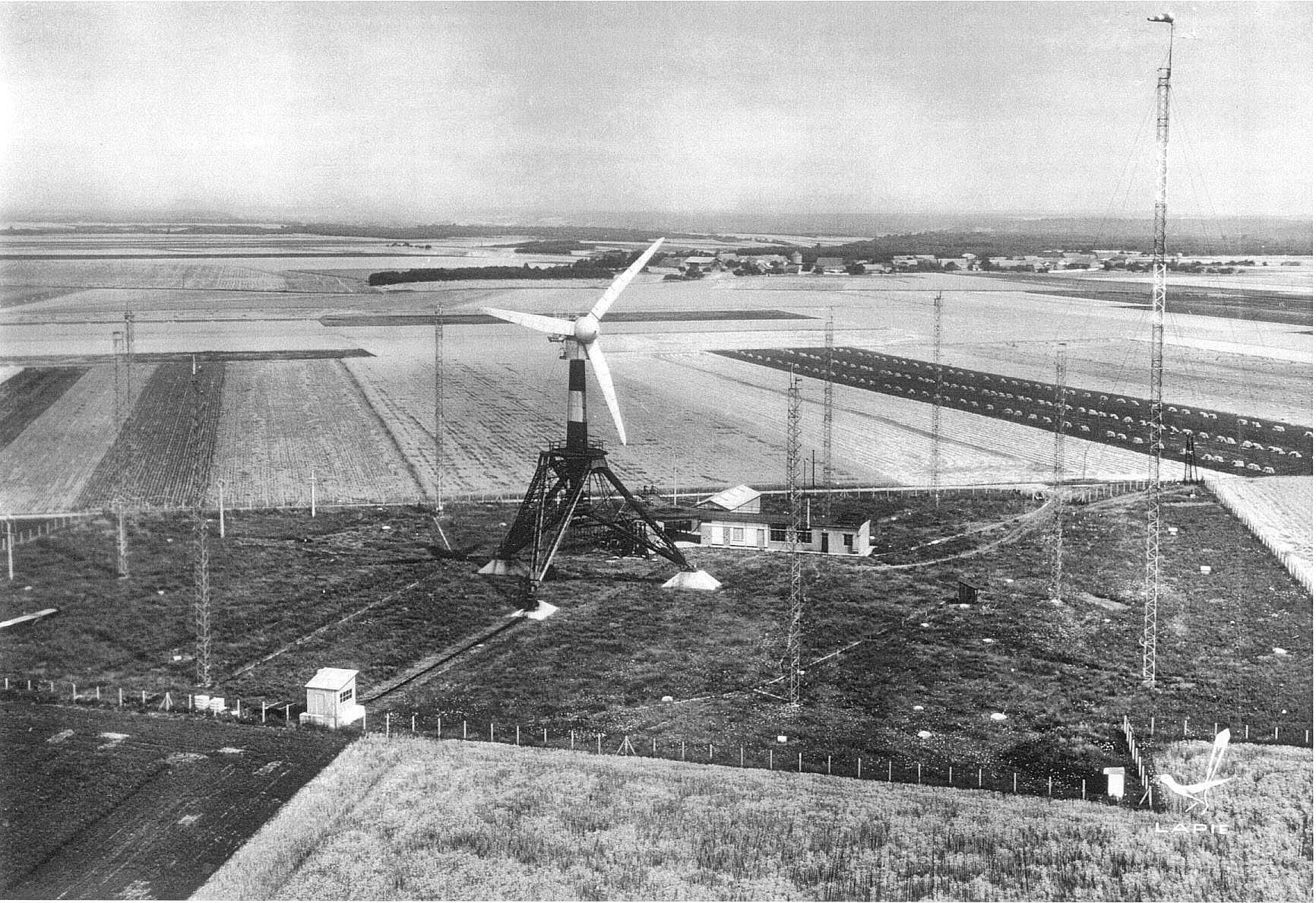
This black and white "Lapie" postcard (above), gives an overview of the terrain. The hamlet of Vaubrun is in the background. In the foreground is the shelter for the South tilting winch and in front of it, placed on railway sleepers, the reeving used during the manoeuvre. The tripod stands on three pedestals: a concrete foundation (100 tons) for anchoring the wind turbine, from which it could be released for tilting, and the two foundations supporting the rotation axes during the tilting manoeuvre (150 tons each). In the background, the research station, in white, housed the offices, measuring instruments and a small workshop. Perpendicular to the laboratory, a shed was used for storage. There was a 1/15th scale model of the tripod (about 1 metre high) which made me dream because it was so similar. I would have gladly accepted it as a Christmas present. Nobody knows what happened to it. It may have been scrapped with the rest. Or maybe someone inherited it without any idea of what it is and it's just lying around somewhere. All around the site you can see the eight 31-metre pylons with their BEST-Romani anemometers and the 60-metre pylon with the windsock on top, which was used to perfect the orientation of the wind turbine. These towers were placed in a circle at a sufficient distance so that the anemometers they supported were not disturbed by the movements of the propeller. Along the path to the winch, one can make out the (dark) hut that housed the station manager during the tilting. This photograph was taken when the wind turbine was stationary, as shown by its orientation concerning the wind direction indicated by the windsock at the top of the 60-metre tower (in operation, the propeller would have been turned in the other direction). The small white building in the lower right corner of the field next to the 'Lapie' logo housed toilets. The photographs of the tilting of the wind turbine were taken from the other side of the field fence, in the field to the right of the photo in the axis "North foot - command hut". |
||
 |
||
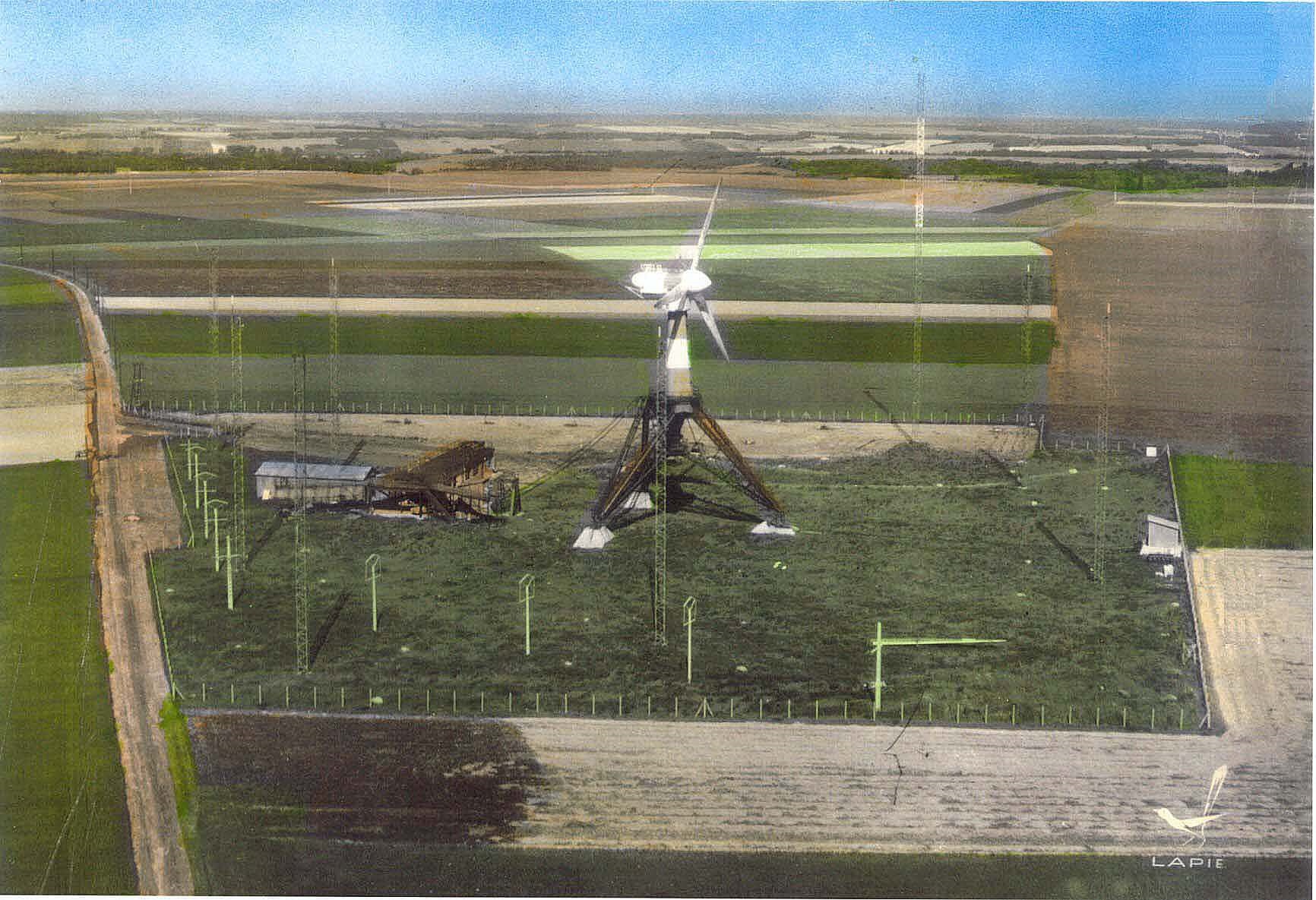
The colourised photograph (above) was taken by the 'Lapie' photographer on the same day as the previous one. On the far right, at the edge of the field, you can see the South winch. In the foreground, then on the left, the concrete pylons of the nickel silver resistance line served as an electric emergency brake in case of a runaway. On the right, behind the last pylon of this line, one can see, laid close to the ground, the fourth blade which had been used in the laboratory for stress resistance tests. In the background, on the left towards the entrance of the station, one can see the 15,000-volt line (on wooden poles) intended to evacuate the production to the SNCF substation of Maintenon and the town of Nogent-le-Roi. |
||
 |
||
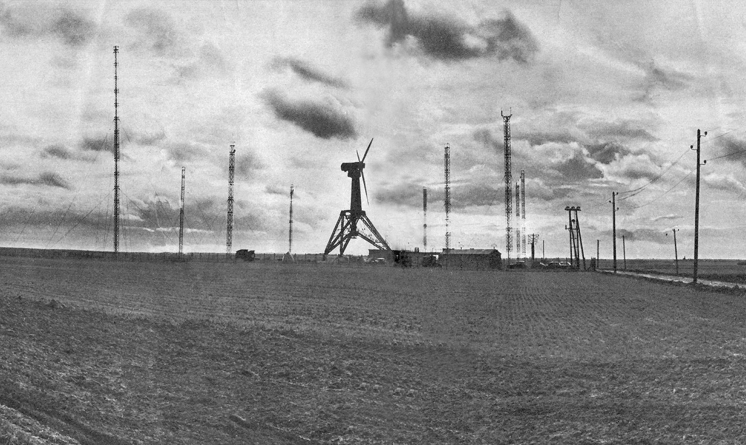
General view of the wind turbine published in the magazine "Contacts" N°11 (EDF Communication Department). May 1958. |
||
 |
||
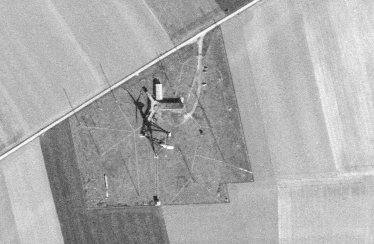
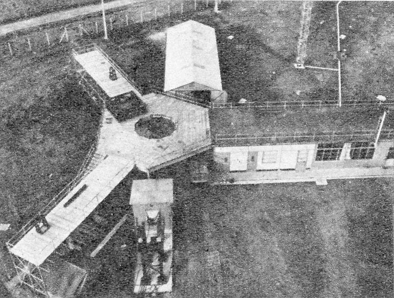
Aerial view of the wind turbine and the terrain. The sun rises in the east-southeast as shown by the shadows of the turbine and the pylons. |
||
 (Click on the pictures to see their actual size). |
||
In this press photo, taken from the upper platform of the tripod, one can see the "Y" arrangement that allowed access to the blades and nacelle when the turbine was tilted. Perpendicular to the hangar in the background is the research station and, in front, the two branches of the "Y" made of "Entrepose" type scaffolding tube connected to the station by a hexagonal structure with a hole for the propeller nose. The roof of the station and the two branches of the "Y" formed a 120-degree angle. In front of the picture, one can see the North winch shelter (from which the cable was attached to the muffle at the top of the tripod) and the IPN support for the wind turbine when it was tilted on. |
Back to the top of the page